Of the many names that have been used to describe the accomplishments of Christopher Columbus, the sobriquet ‘Great Navigator’ is a favorite among historians. Many assume that the title was bestowed because Columbus crossed the Atlantic and discovered the New World. They are only partly correct. At the time of Columbus, celestial navigation – the use of the stars for navigation, a method that is used to this day, was in its infancy. Sailors of Columbus’ day instead navigated using dead reckoning. The navigator found his position by measuring the course and distance sailed from some known point. From a location, such as a port, the navigator would estimate how far the ship had traveled, marking the point on a chart. Each day’s ending position would be the starting point for the next day’s course-and-distance measurement.
The ship’s course was measured using a magnetic compass. Distance was determined by a time and speed calculation. The passage of time was noted by a sandglass that had to be turned every half hour. The time of day could be determined at least three times a day: sunrise, noon and sunset. Columbus likely had tables that told him the times of sunrise and sunset for each day of the year and would have been able to determine noon by the position of the sun.
The ship’s speed was measured by throwing a piece of flotsam over the side of the ship and measuring how long it took to pass between two marks on the ship. When it passed the forward mark, the pilot would start a quick chant until it reached the aft mark. The exact words to the chant are part of a lost oral tradition of medieval navigation. The pilot would note the last syllable reached in the chant and he had a mnemonic that would convert that syllable into a speed in miles per hour.
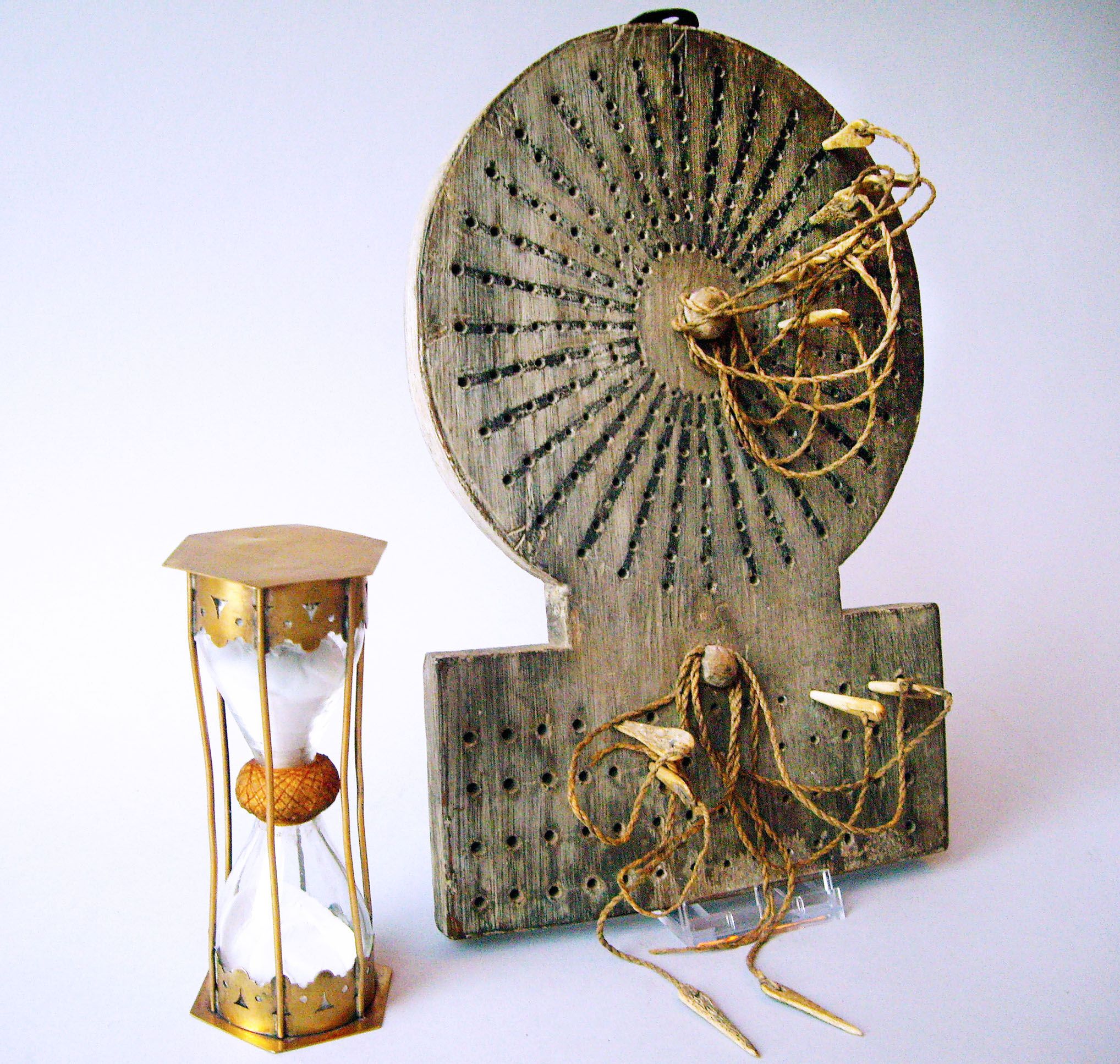
Speed and distance were measured every hour. The officer of the watch would keep track of the speed and course by using a toleta or traverse board. This was a peg-board with holes radiating from the center along every point of the compass. The peg was moved from the center along the course traveled for the distance made during that hour. After four hours, another peg was used to represent the distance made good in leagues during the whole watch. At the end of the day, the total distance and course for the day was transferred to the chart. It is by no means an accurate method, but it was the best that could be applied in the late 15th century. It was sufficient for navigators of the day, since most did not stray too far from the coast.
Columbus was the first sailor who kept a detailed log of his voyages and was extraordinarily proficient using dead reckoning. On the first voyage westbound, Columbus maintained his (magnetic) westward course for weeks at a time. Only three times does Columbus depart from this course; once due to contrary winds and twice to chase false signs of land to the southwest. What is remarkable about his voyages to the New World is that his ships reached exactly where he intended to go, it is just that he had one crucial flaw in his assumptions. Columbus thought one degree of longitude was 56.66 miles long, which would make the circumference of the Earth 20,400 miles, an underestimate of about 25 percent. One degree of longitude is 69.171 miles at the equator and it decreases as you approach the poles. Using the data that was available to him, he calculated a distance from the Canary Islands to China of 3,000 miles. Columbus sailed to exactly where he thought the Orient was; it just happened to be the Americas!